The Air Force Turned Off GPS To Rehearse a War Without It
Red Flag 2018 is a dry run for a war without satellite navigation.
By Eric Tegler

USAF/JAMIE NICLEY
The U.S. military is worryingly dependent on GPS. Our global positioning satellites tell planes where they are, provide targeting info for smart weapons, and support communication and navigation systems. But in a war with a tech-advanced adversary—think China, Russia, or Iran—GPS could become a big liability because it could be jammed, spoofed, or outright destroyed.
So how does the U.S. Air Force train for such a scenario? Simple—just turn it off.
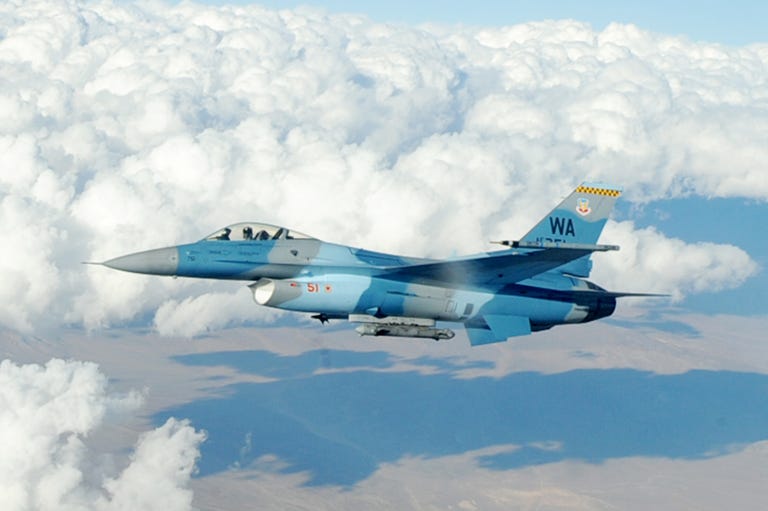
Red Flag is the Air Force’s top air war training exercise, bringing together USAF fighter, bomber, tanker, and ISR squadrons with select allies for coordinated training over the 5,000 square-mile Nevada Test and Training Range (NTTR). For Red Flag 2018, which kicked off last week and will run through February 16, the Air Force will black out GPS, forcing aircrews to execute strike missions without their familiar satellite-based guide.
Bring on the Blackout
The blackout won't be quite as precise as America's precision fighters, though. GPS could be knocked out for adjacent airspace as well, potentially disrupting airliners and private planes in portions of Nevada, California, Arizona, and Utah. Affected civilian aircraft will have to turn to other onboard radio or inertial navigation system (INS) or rely on air traffic control radar vectors.
This isn't the Air Force's first self-imposed blackout, having previously turned off GPS during Red Flag exercises in Alaska. The Air Force tells Popular Mechanics that there will be "little to no effect" for civilian aircraft. And yet the fact that there could be a disruption of civil GPS service in the continental U.S. shows the increasing importance of training for a GPS-less scenario.
ALLOWING POTENTIAL DISRUPTION OF CIVIL GPS SERVICE IN THE CONTINENTAL U.S. SHOWS THE INCREASING IMPORTANCE OF “GPS-DENIED” TRAINING.
USAF aircrews began flying GPS-denied training sorties in 2010 as part of an initiative called “Readiness Project 2.” In 2013, the service developed a system called Simulated Programmable Aircraft-Embedded Jammer, which can realistically simulate GPS jamming on one plane's equipment without affecting others.
How the Air Force disrupts GPS over a large area like the Nevada range remains classified, but it's been developing the tech for more than a decade. To pull off such a blackout requires intense levels of interagency coordination and resources, but it presents a realistic GPS-denied training opportunity like no other. The result is "the largest Red Flag ever with the largest number of participants, highlighting the balance of training efficiency with mission effectiveness,” according to Col. Michael Mathes, 414th combat training squadron commander, in an Air Force press release.

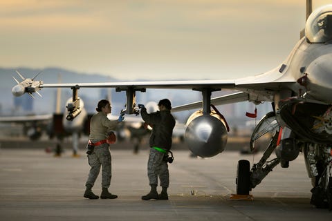
Two back-shop armament technicians work on an F-16 on day two of Red Flag at Nellis Air Force Base.
USAF/BEN BLOKER
The participants include the U.S.'s closest allies, U.K. and Australia, indicating the sensitive nature of this particular Red Flag. Mathes also said the focus would be on strike missions where multiple aircraft practice flying to a surface target, evading enemy sensors and aircraft, dropping their weapons, and departing—and fighting their way in and out if necessary.
Fighting in the Dark
So how do fighter, bomber, and tanker crews do that safely without GPS?
Many Air Force planes, including the F-15, F-22 and F-35, have accurate onboard inertial navigation systems. Basically a computer with accelerometers, gyroscopes, and magnetic sensors, this nav system continuously calculates positioning and requires no outside data. Fighter planes can also use their AESA-scanned array radars in concert with inertial navigation to find their way over shorter ranges if need be. Aircraft electro-optical and infrared sensors can also read terrain over short distances to provide additional navigation.
Outside of the airplane, offboard systems can be used for navigation if strike aircraft still have reliable communications or datalinks. For example, E-8 JSTARS flying outside the GPS-disrupted zone may be able to pass on position and targeting information. Strike aircraft can also use laser-guided munitions as another weapons alternative.
These workarounds are effective, and a reminder that the U.S. was a fearsome fighting force long before GPS came around. But if our strike aircraft are operating in a scenario where GPS goes silent, it’s reasonable to assume that communications and datalinks won't be faring much better. Getting the mission done without the sophisticated tools we’ve become so accustomed to is a concept that the Air Force calls “resiliency," and it’s an idea worth embracing.
So while civilian airplanes traversing this patch of American West could hit some non-threatening GPS turbulence, it's worth remembering that it's all for country.
No comments:
Post a Comment